

 한국어
 English
 Français
 日本語
 DRTView for Windows
DRTView,
now on Windows
Open-source ground control software is built for developers, so everything is shown at once. DRTView shows the operator only what matters now, in a form that is easy to read, and keeps every developer tool one level deeper.
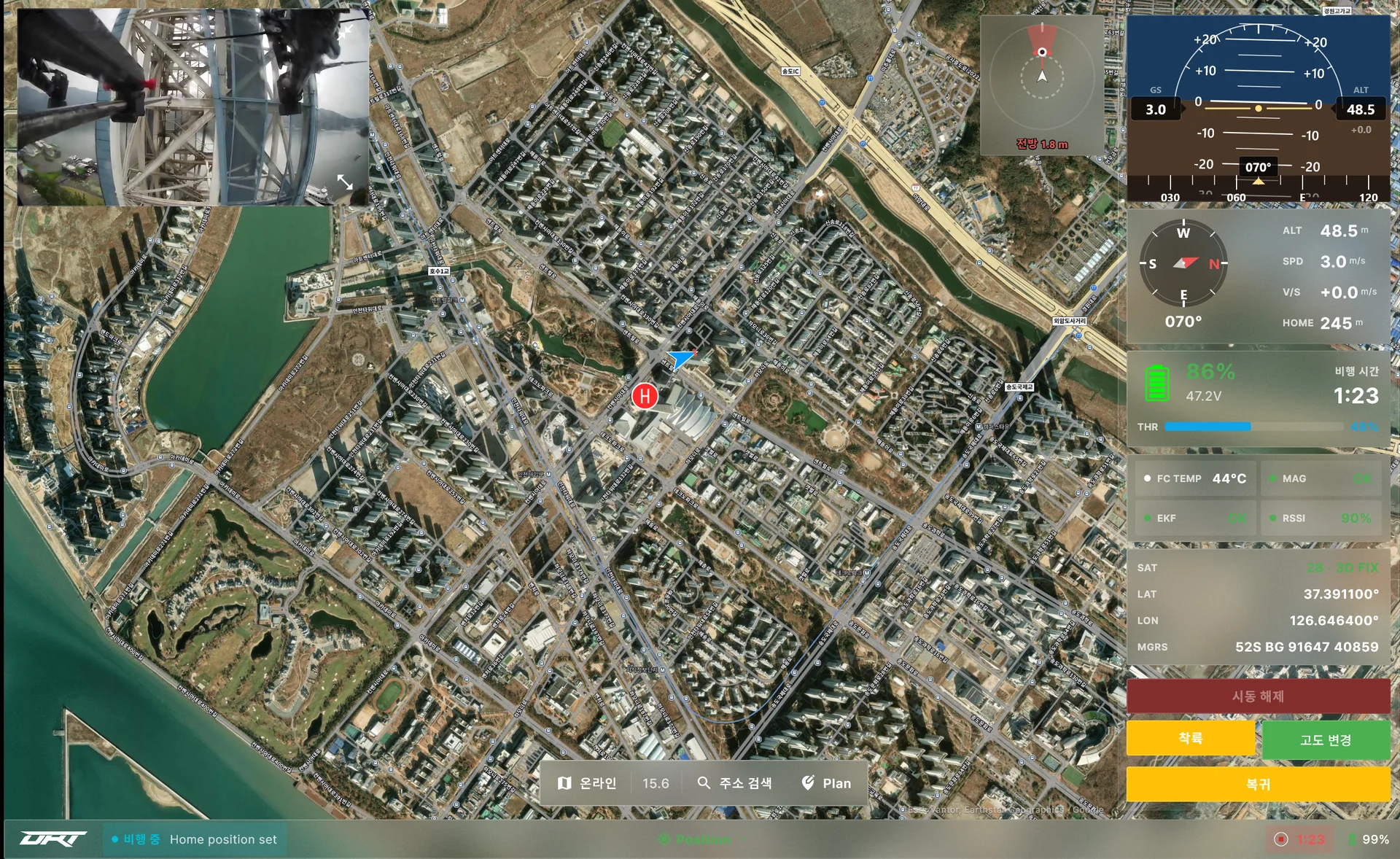
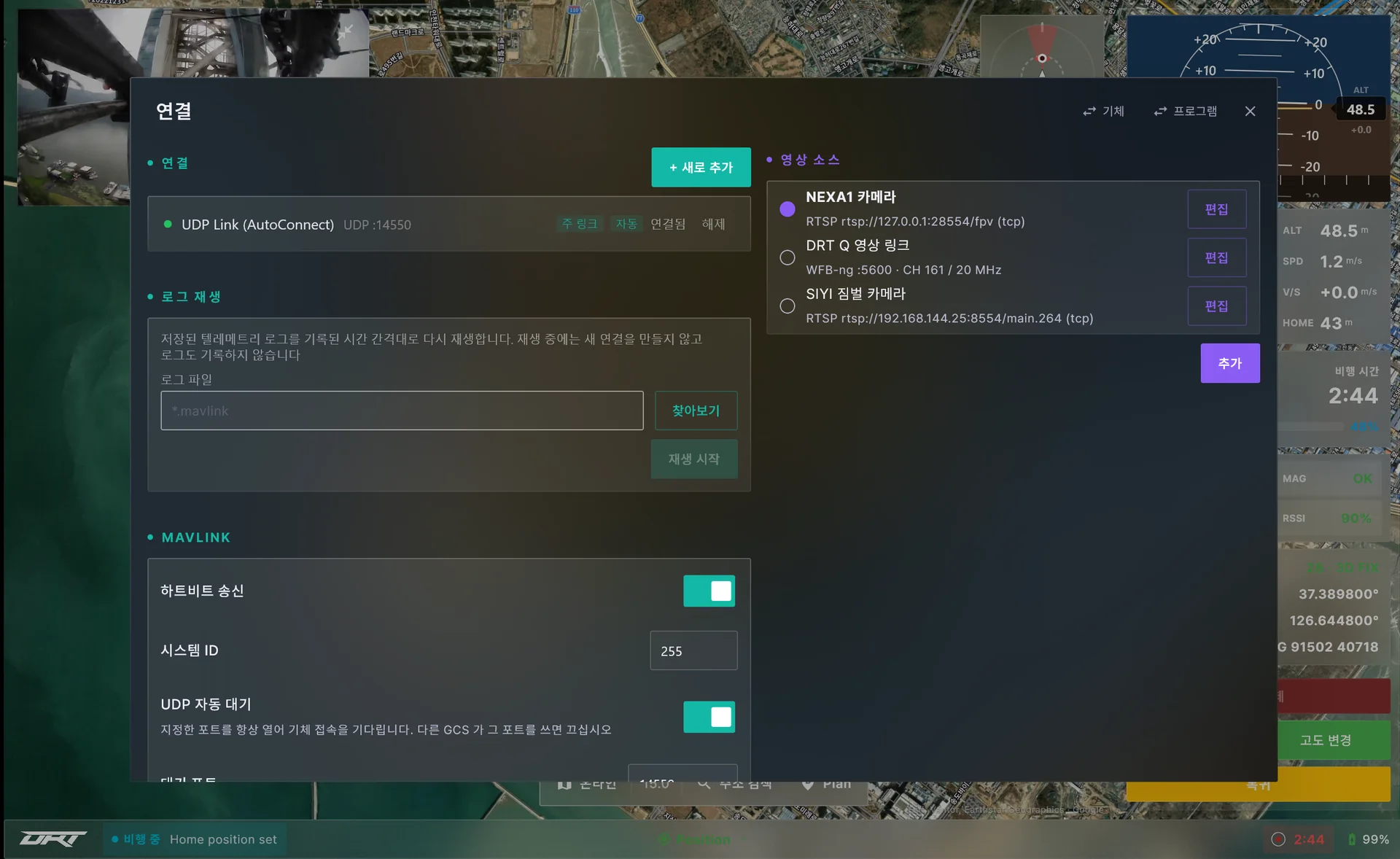
Every screen on this page is a real app screen, not a mockup.
User-centered UI/UX
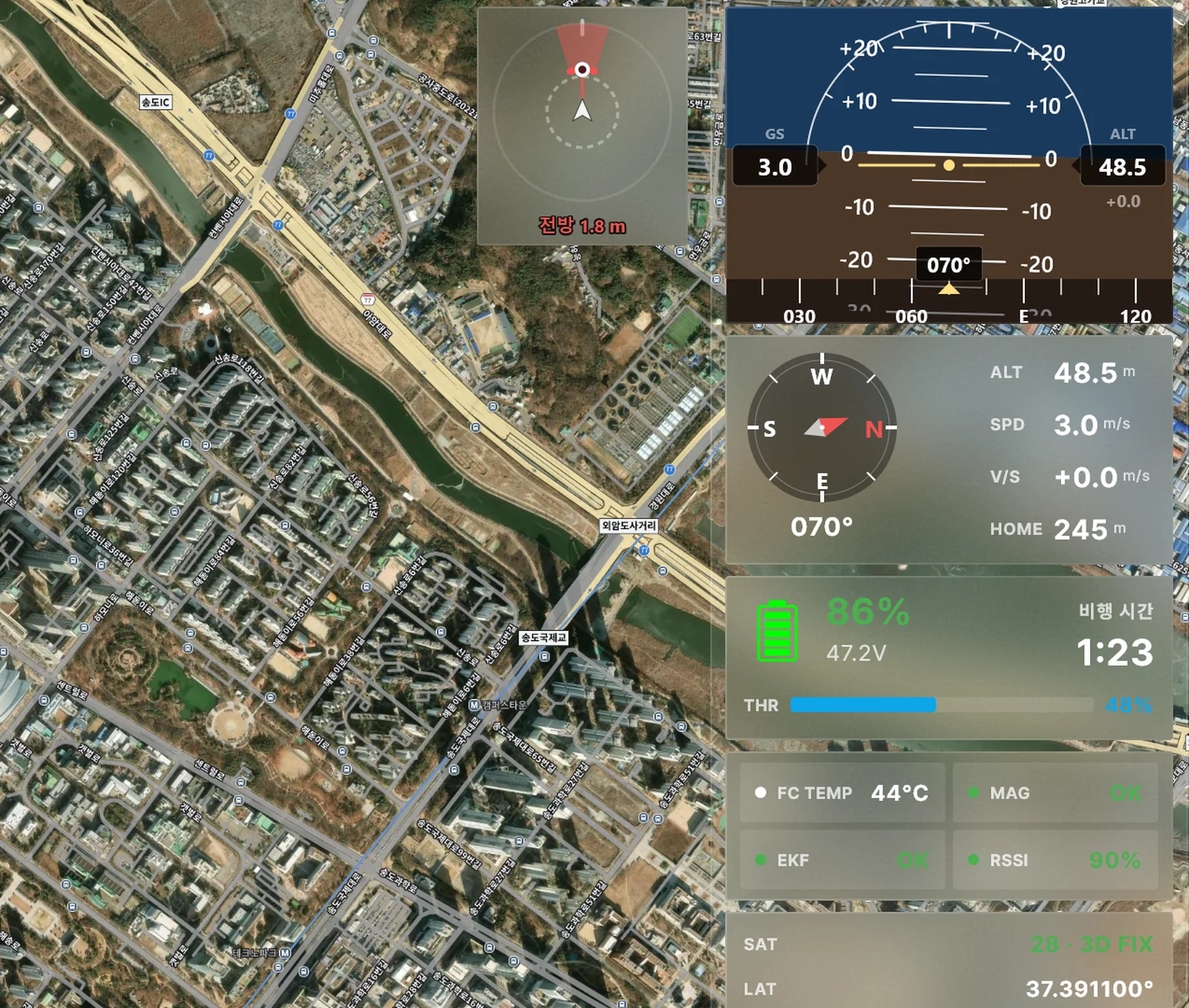
Where general-purpose software lists every item on one screen for developers, DRTView arranges settings in the natural order connect → check → fly → review, shows status in color and graphics on every screen, and uses natural wording throughout.
- Settings flow
- Tabs in connect, check, fly, review order
- Visualization
- Status chips, instruments, tracks and airspace in color and graphics
- Native wording
- Terms, warnings and voice prompts in Korean, English and Japanese
- Safe operation
- Commands run on press-and-hold
- Developer tools
- Parameter editing with diff, MAVLink console and calibration one level deeper
Offline map support
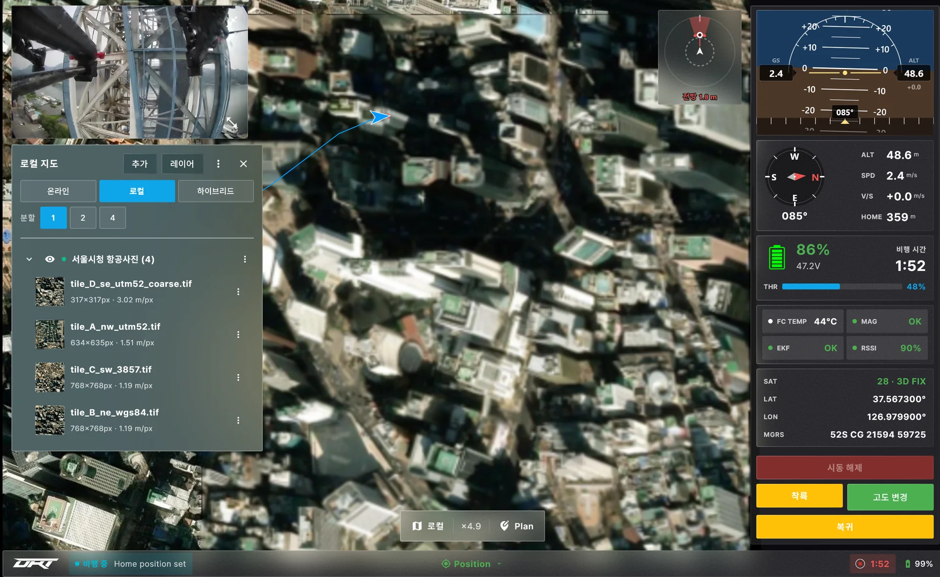
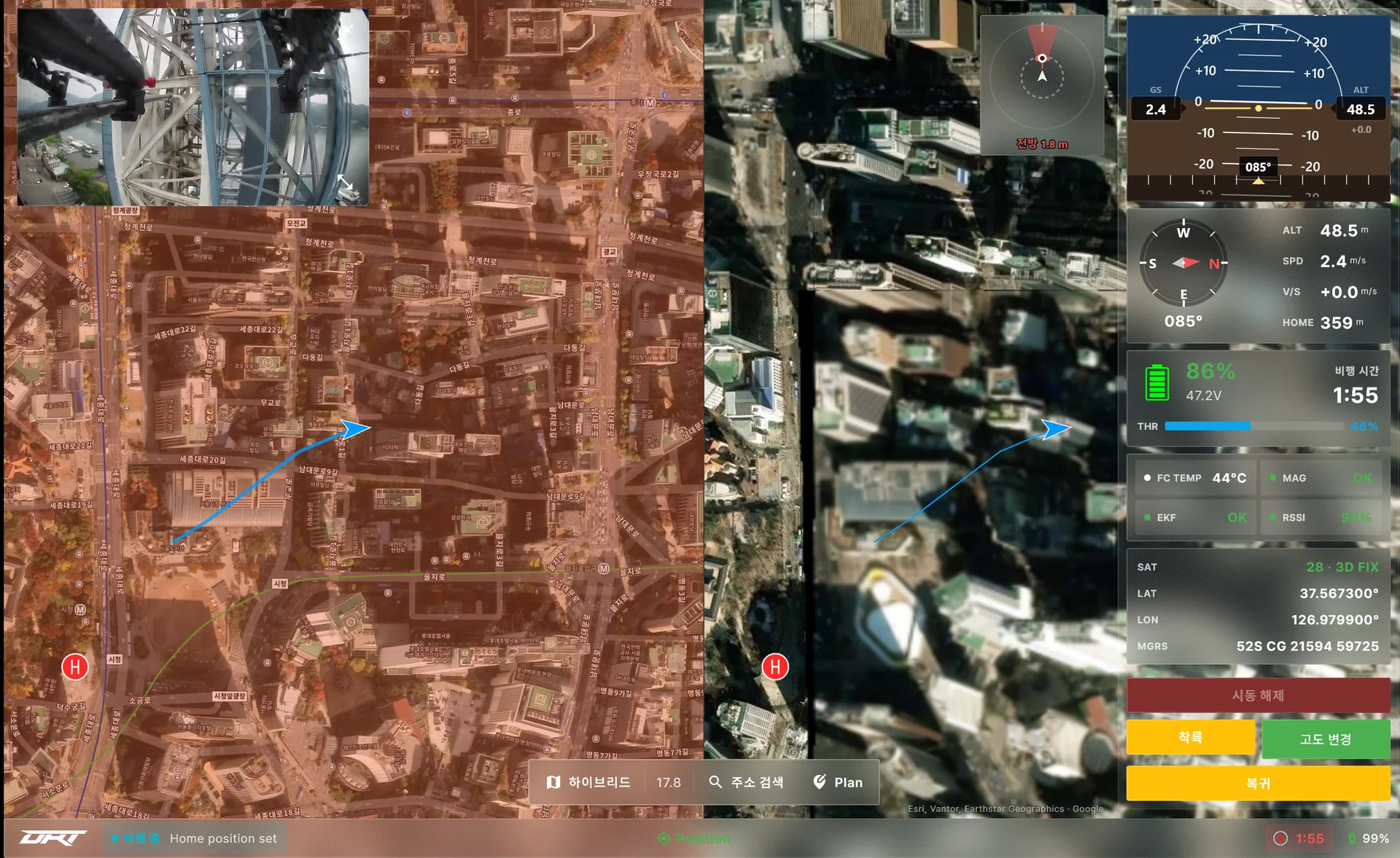
Unlike software tied to online tile maps, closed networks in defense and public agencies can use their own aerial imagery and map files as the base map.
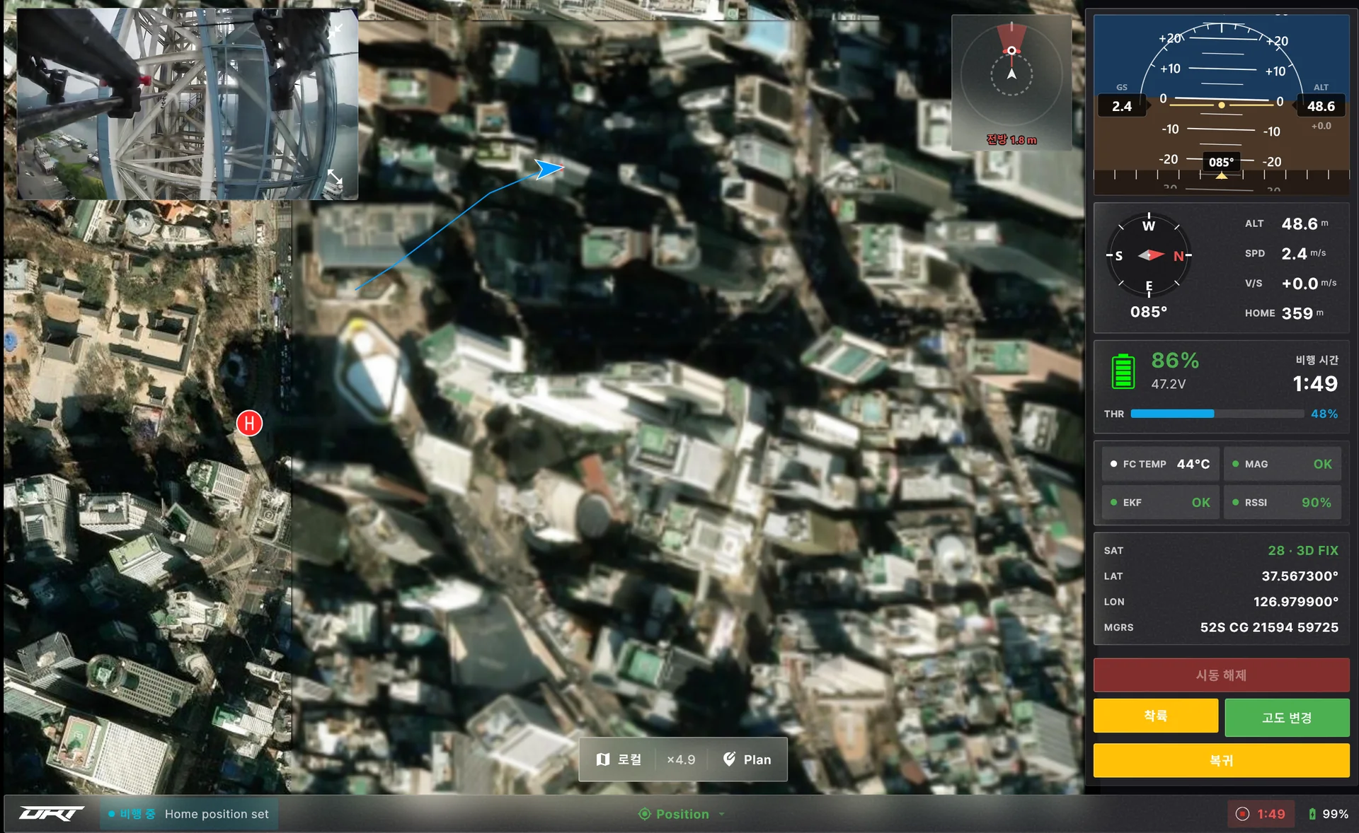
Formats
GeoTIFF and COG files, drag and drop
Automatic stitching
Several tiles cover the whole operating area
Compare with online map
Overlay, 2- or 4-way split
Map cache
Imagery and place names seen once, reused offline
Multi-vehicle control
Instead of switching between vehicles one at a time, every vehicle's status sits side by side on one screen and commands go only to the vehicle you choose.
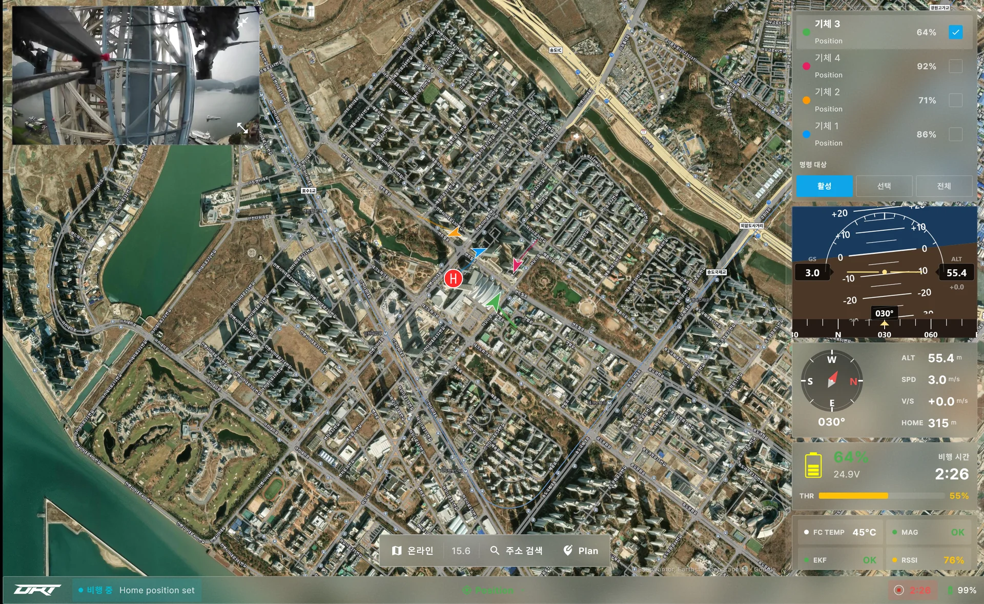
Card per vehicle
Status, battery, mode, color-coded markers and tracks
Command target
Active, selected or all, risky commands to the active vehicle only
Video per vehicle
Source per vehicle and camera
Voice alerts
Battery, link and warnings of off-screen vehicles
Many video sources
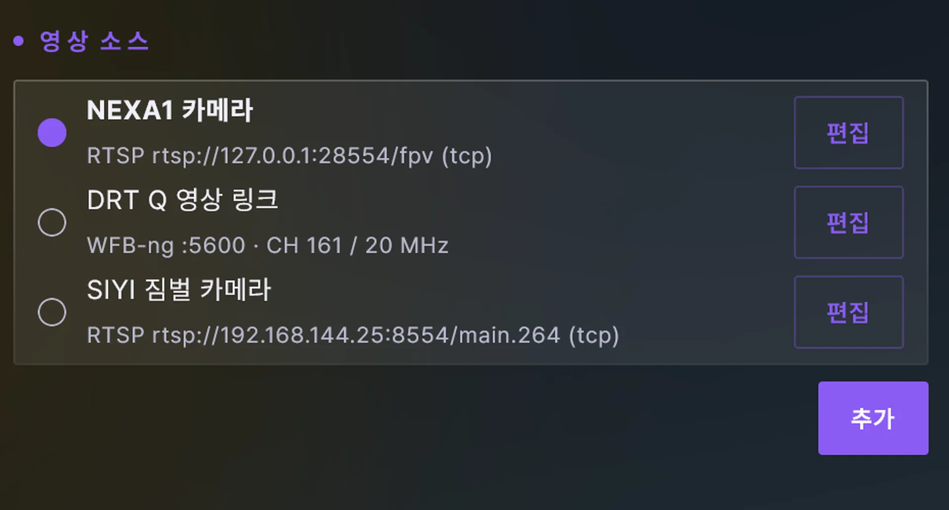
Register several video sources, including WFB-ng (OpenIPC) video that other ground control software cannot receive, plus RTSP and UDP, and switch between them.
- WFB-ng direct
- One USB receiver, encryption and error correction built in
- RTSP and UDP cameras
- Low-latency IP camera video
- Source switching
- Picked on the flight screen
- Recording
- Original quality, no re-encoding
Many mission types
Existing mission editors bury the job under menus and fields. In DRTView you pick the mission type and draw the area on the map, the path is generated, and survey, corridor and structure-inspection missions are planned in a few steps and flown automatically.
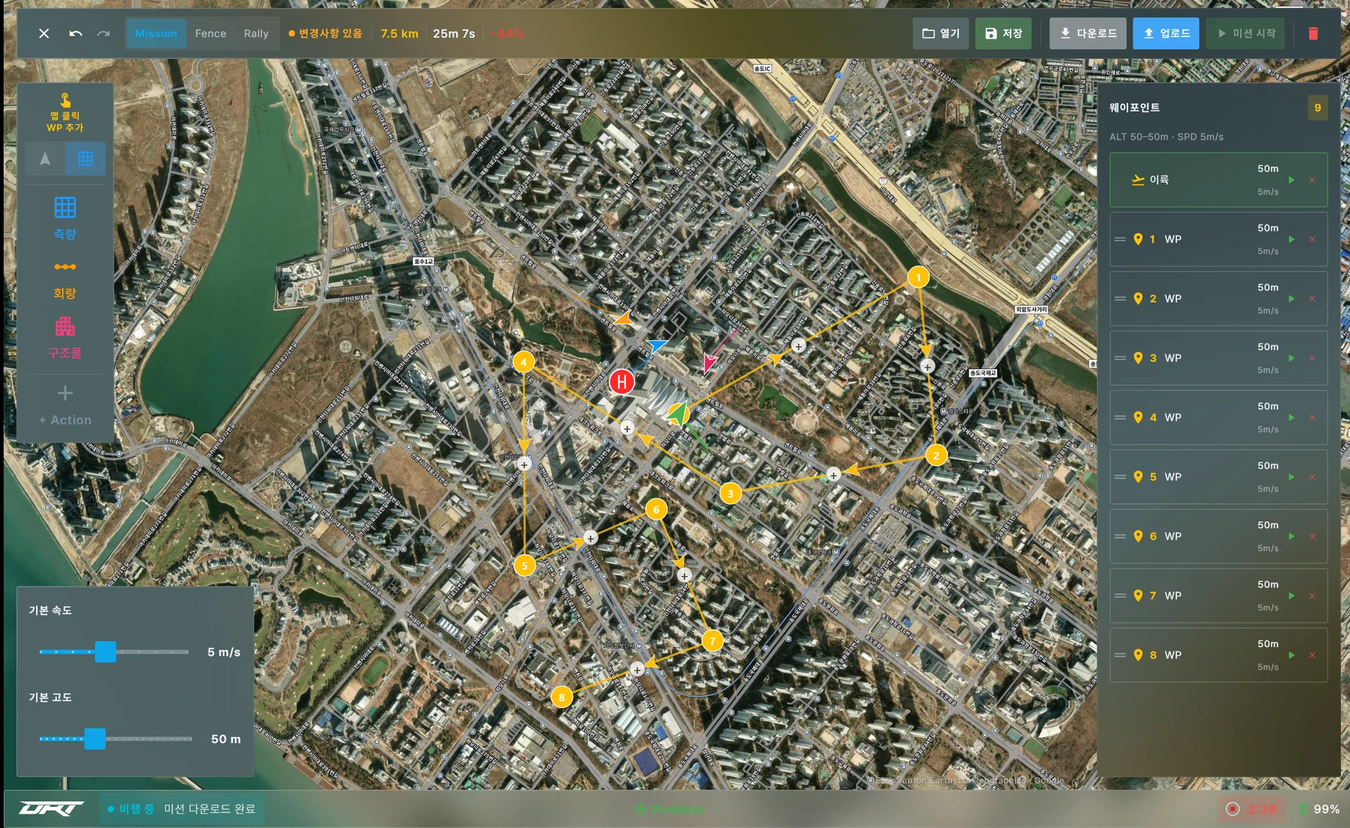
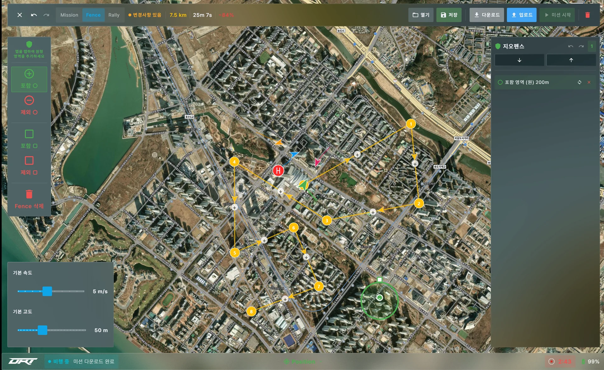
- Mission types
- Waypoints, survey area, corridor, structure scan, with automatic paths
- Safety
- Geofence and rally points uploaded together
- Preview
- Distance, time and battery estimate
- Save and reload
- .plan files for repeating the same mission
Airspace and address search
Airspace and site location, once checked on separate websites, are confirmed on the map with a single address search.
- Airspace display
- No-fly, control and restricted zones by color, name and class on tap
- Address search
- Road names without numbers, partial numbers, suggestions while typing
- Offline
- Saved airspace and address data, no connection needed
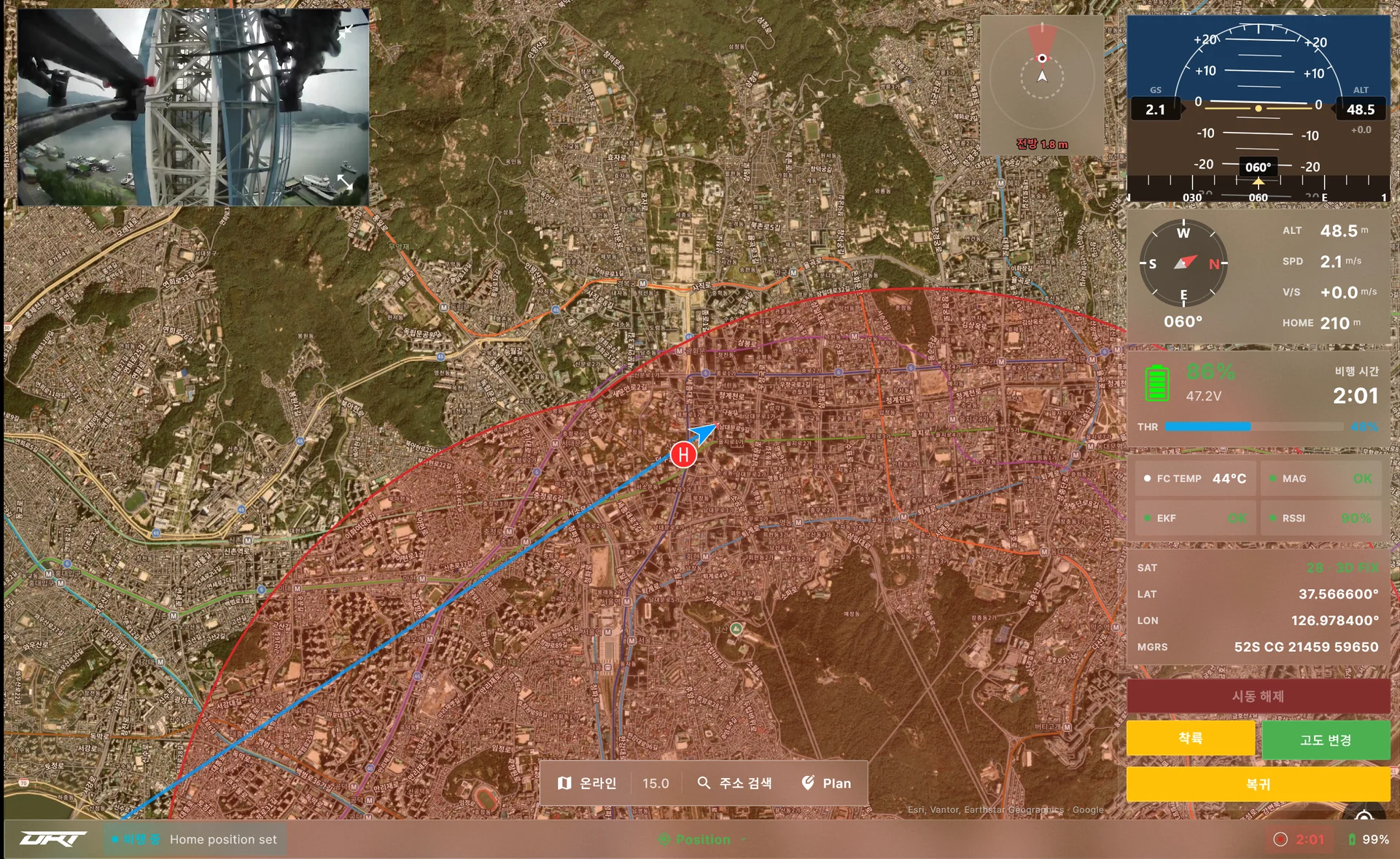
Dedicated screens for DRT aircraft
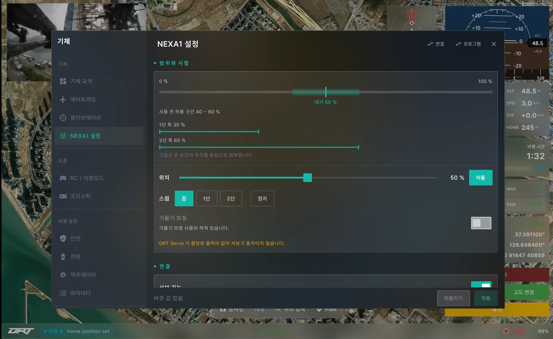
Connect a NEXA1, DRT-Q or DRT-T and the screens and settings for that aircraft are added automatically, while the general features stay.
- Automatic recognition
- The vehicle reports its model, nothing to select
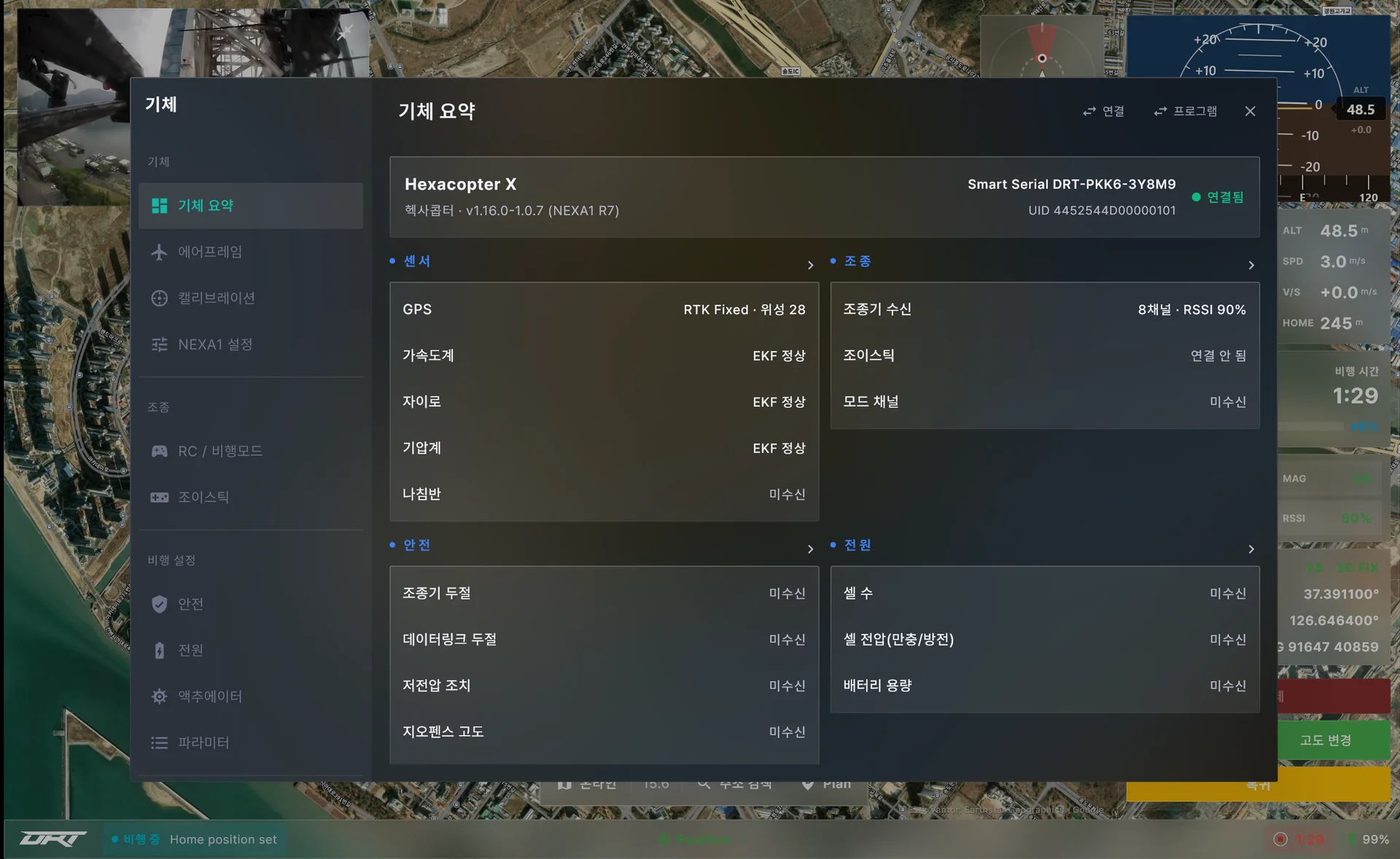
- Vehicle summary
- Model, smart serial, sensors, control, safety, power
- NEXA1 settings
- Settings tab for cleaning work
Any kind of link
USB, UDP, TCP or Bluetooth all give the same screen, and with several links connected a dropped link hands over automatically.
- Supported links
- USB (auto-detected), UDP, TCP, Bluetooth
- Multiple links
- Automatic handover when the primary link drops
- Forwarding and signing
- MAVLink forwarded to other software, control commands signed
- Log replay
- Recordings replayed at their original pace, pause, speed, seek
Maintained steadily
The Windows edition is updated in the same flow as Android: 19 Windows releases in 2026, with 173 Windows developer builds in between, and releases ship after testing on real aircraft. These are the three most recent releases.
- Quick Vehicle Setup redesigned — Set the flight limit altitude and distance, the return altitude and what happens after return, and the auto takeoff altitude with buttons on one screen
- Collision prevention settings appear only on vehicles with collision prevention turned on
- Address search appears only when the app language is Korean
- RC 캘리브레이션 화면에서 다음 단추가 늘 보이고 채널을 두 줄로 보여 줍니다
- 모터 시험의 프로펠러 제거 확인을 맨 앞으로 옮겼습니다
- 일부페이지에서 누락된 재부팅안내를 정상적으로 출력합니다
- Redesigned vehicle settings pages and improved connection and obstacle display — NEXA1 lance servo and DRT Q settings pages are reorganized so no setting appears twice, and servo output, travel range, direction and the turtle start switch are set right on the page
- Added a NEXA10 nozzle servo settings page
- The obstacle distance ribbon and CP display are less cluttered with one set of safety colors, and the map shows the aircraft and obstacles indoors without GPS

DRTView on your Windows PC as well
Windows 10 or later, 64-bit · installs without admin rights · automatic updates
DOWNLOADDownload the Windows installer from Support.