

 한국어
 English
 Français
 日本語
NEXA1
A drone that cleans facades and solar panels where people cannot go
Water is pumped up from the ground and power comes through a cable, so it cleans high-rise facades without rope access.It holds its position even next to buildings where GPS is blocked.
- 725m²/hCleaning rate per hour
- 220barMax water pressure
- 100mMax working height
- IPX5Water-jet resistant
Cleaning in dangerous places, NEXA1 does it for you.
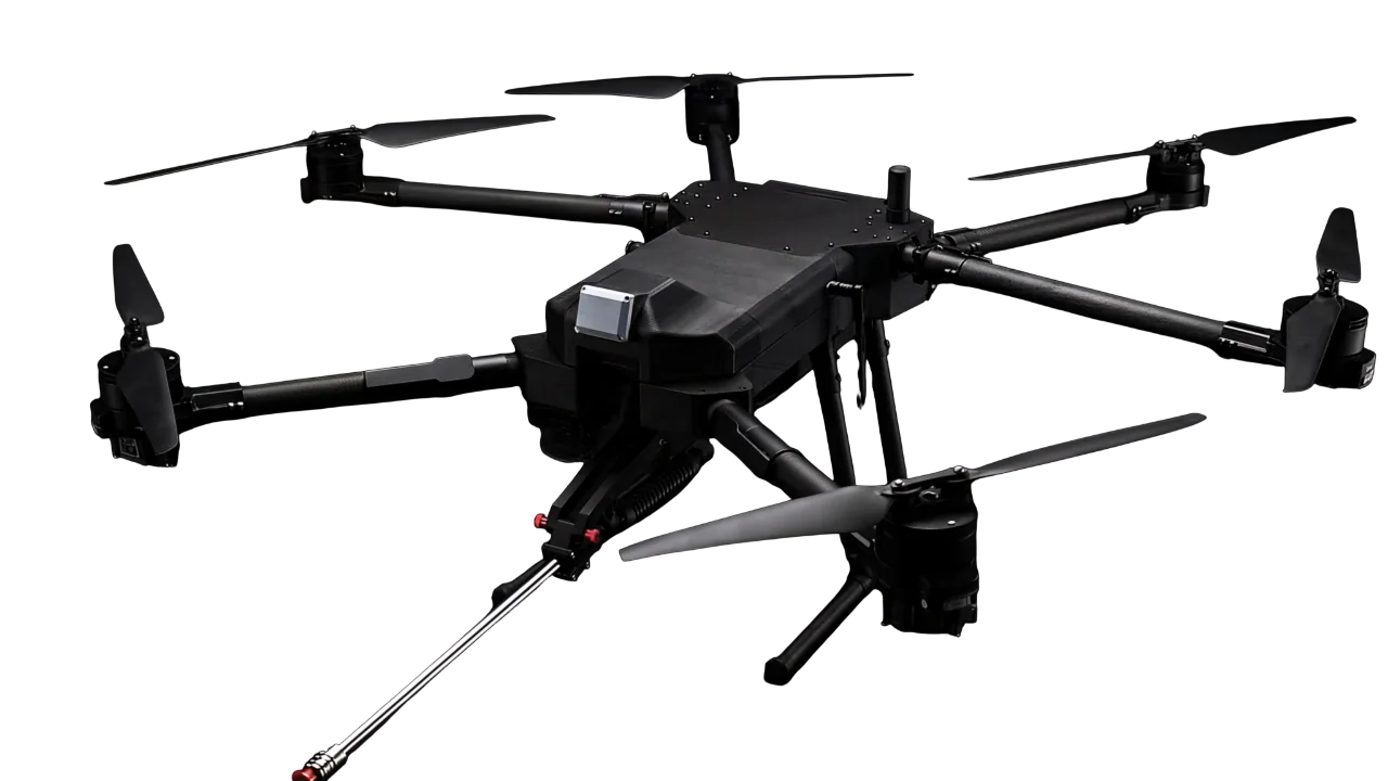
From building facades to solar panels, the drone cleans places that are difficult for people to reach.It holds its position with its sensors even without satellite signals, and water and power come up from the ground without interruption.
Position hold without GPS
Sensors recognize the surrounding buildings, so it holds still next to buildings, under bridges and indoors.
Lance Auto Sweep
A 45° tilting lance moves automatically and cleans a wide surface in one pass.
Tether power
It receives 220 V ground power through a cable and works with no battery swaps.
LiDAR·Radar dual sensors
They detect every obstacle and alert you with voice and warning tones.
IPX5 water resistance
The view and the gimbal stay steady even while it sprays water.
Foldable structure
It folds to 1/3 of its size in seconds for transport and storage.
Water from the ground, a light aircraft.
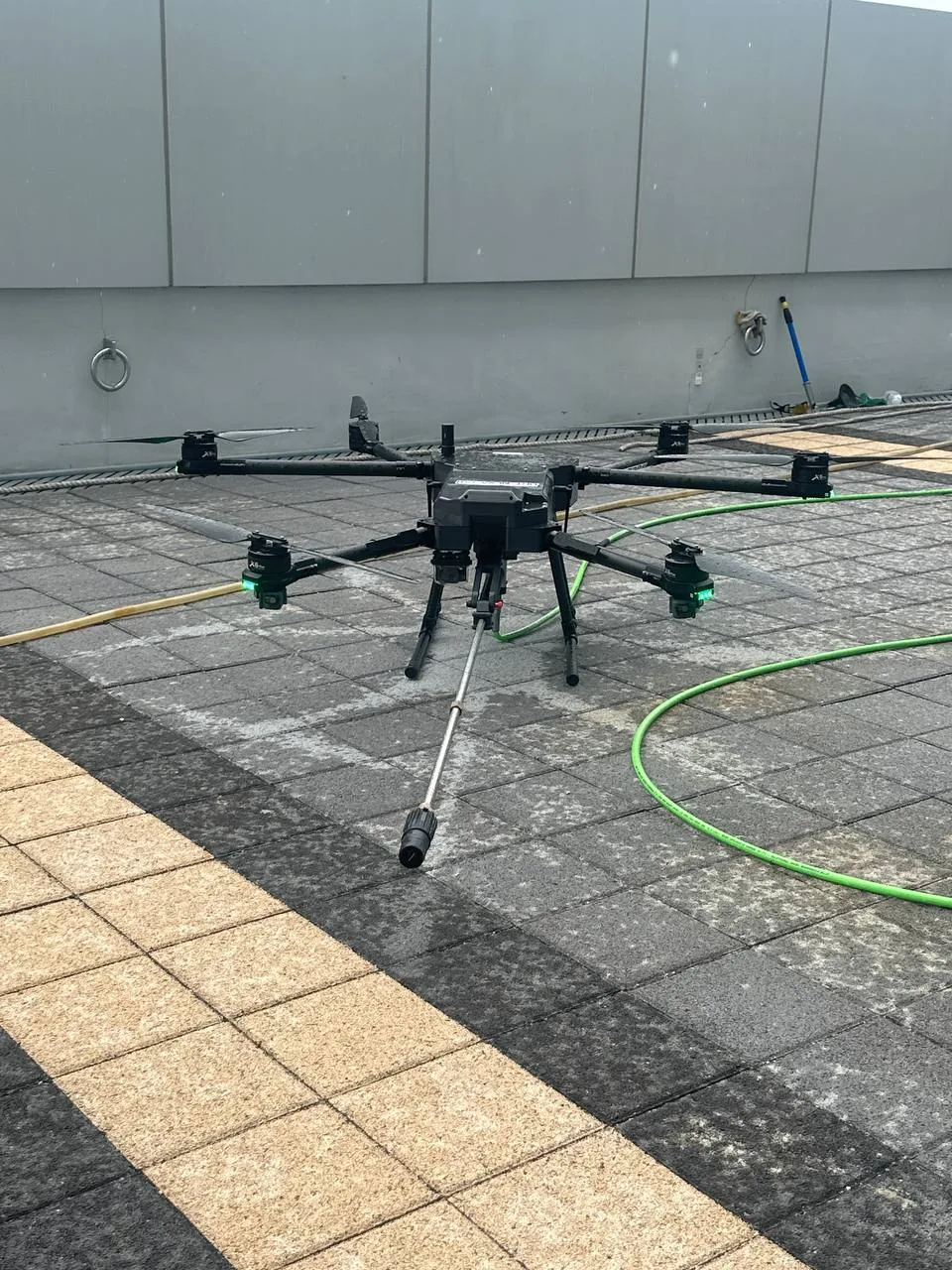
The aircraft carries no water tank.A high-pressure pump on the ground sends water up through a hose, and the aircraft only tilts the lance and sprays.
- 1Water supply
Mains water or a tank feeds the pump through a DI filter that produces ultra-pure water. Detergent can also be added with a mixer.
- 2High-pressure pump (on the ground)
Pressurizes the water: up to 220 bar at 20 L/min, or 120 bar at 50 L/min. Spraying starts and stops with the pump.
- 3High-pressure hose
Carries the water up to the drone. Working height up to 100 m; the actual limit depends on the weight of the hose. A ground crew member guides the hose.
- 4Tilting lance
The lance tilts up and down over 45°. Auto Sweep moves it automatically, so each pass covers more wall with less drone movement, and pointing it down makes solar panels below the drone easy to clean.
- 5Nozzle and jet
The nozzle sprays a high-pressure jet onto the surface: facades, windows, solar panels.
- 6Holds position against the recoil
The jet pushes the drone backwards. NEXA1 measures its position and compensates automatically to stay in place.
A light power cable converts ground power to DC and feeds the drone in flight: unlimited flight time, no battery swaps.
unlimited with the Tether option
Pump, hose, mixer and water supply: standard ground equipment chosen for each site.
It holds still even where GPS is blocked.
Ordinary drones fix their position from satellite signals, so where the sky is hidden, such as right next to a building or under a bridge, their position jumps and the aircraft drifts.That is exactly where a cleaning drone works.NEXA1 recognizes the surrounding buildings with its on-board sensors and fixes its own position.
Right next to a building
Satellites are hidden, so the position jumps and it drifts toward the wall.
It measures the distance to the wall with its sensors and holds its place.
Between high-rise buildings
Reflected signals make the position error larger.
It fixes its position on the surrounding buildings and stays steady.
Under a bridge · Indoors
It loses its position, so only manual control is possible or flight is difficult.
It holds position and moves even without satellites.
Obstacles
It has a forward sensor only, or it only gives a warning.
It watches in all directions, avoids obstacles and warns the pilot.
3D maps recorded in real flights
NEXA1 measures its surroundings with a 3D LiDAR and stitches the measured points together to compute the map and the aircraft position at the same time (SLAM). The maps below were recorded by NEXA1 in flight, and you can rotate and zoom them.
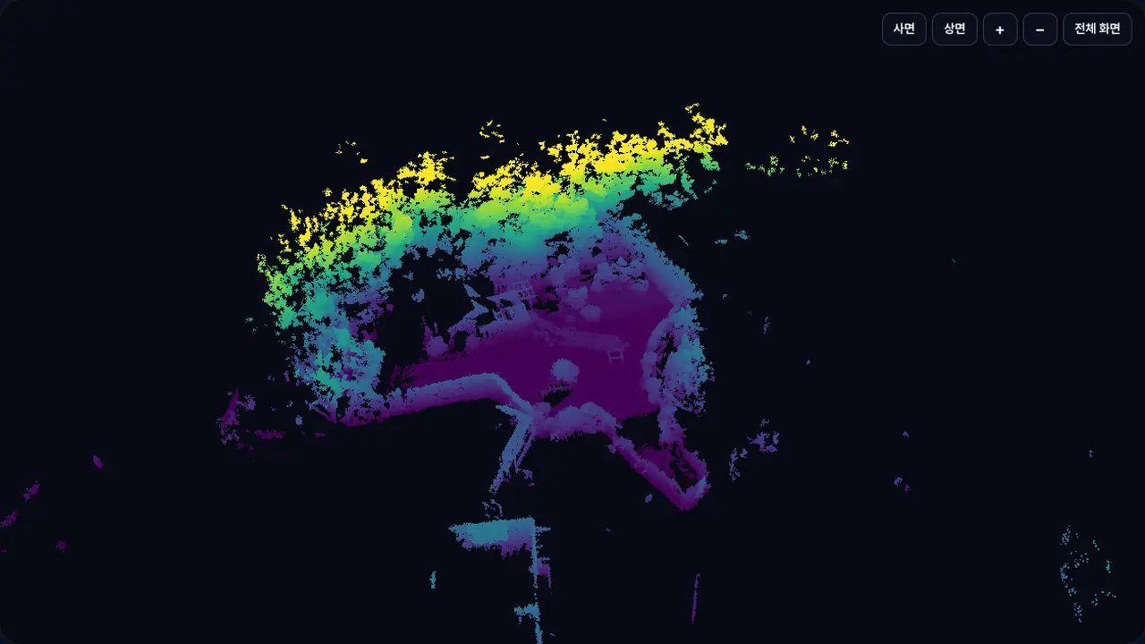

Map area approx. 83 × 69 m · 740k points shown (1.31M original, 12 cm spacing for the web)
Solar plant cleaning job · 3 flights · Map area approx. 104 × 103 m · 910k points shown (8.78M original, 16 cm spacing for the web)
Color = height above ground
Purple is the ground, blue to green is 5 m to 15 m, and yellow is 20 m and above. Black gaps are areas the laser did not reach, and one point is one place where the laser reflected.
How SLAM works
- 01Measure360° distance measurement around the aircraft with a 3D LiDAR
- 02AlignEach new measurement is aligned with the existing map to compute the aircraft position and extend the map
- 03ControlThe computed position goes to flight control in real time to hold position without GPS
Both maps are built only from LiDAR measurements recorded in flight. No photos or satellite maps are added.
In one pass,
a wide surface, clean.
The lance tilts 45° up and down.Auto Sweep moves the lance automatically, so the aircraft moves less and cleans a wider surface in one pass, and when the lance points down, it also cleans solar panels below the aircraft.
- +40%Higher cleaning rate
- 45°Max tilt angle
- 220barMax water pressure
Set two points,
and the drone cleans on its own.
When you set two points, A and B, the aircraft makes a zigzag path along the wall and climbs, cleaning every part of it.The pilot controls only the throttle.
Automatic path generation
Climbs in a zigzag between the two points and covers every part
Automatic wall distance hold
Holds the set distance even against high-pressure spray recoil
One-touch control · Less fatigue
A wide facade cleaned evenly with the throttle alone, with the same quality over long sessions

Beyond the limits of the battery.
220 V → DC
Ground power is converted and supplied through a light cable without interruption in flight.
Unlimited flight
No battery swaps and no waiting for a charge.
Uninterrupted work
Even large buildings are finished in one go.
Even in the spray,
a steady view.
An IPX5-rated design and a water-repellent cover keep the view clear and the 1-axis gimbal stable while the drone sprays water during cleaning.
1080p ultra-wide camera
160° lens, 1/2.7" CMOS sensor
Ultra-low-latency streaming
Real-time RTSP H.264 transmission and recording
1-axis gimbal stabilization
Steady video even in splashing water
Safe flight with no blind spots.
Two types of sensors, LiDAR and Radar, detect obstacles on the flight path and alert the pilot on screen and with sound.
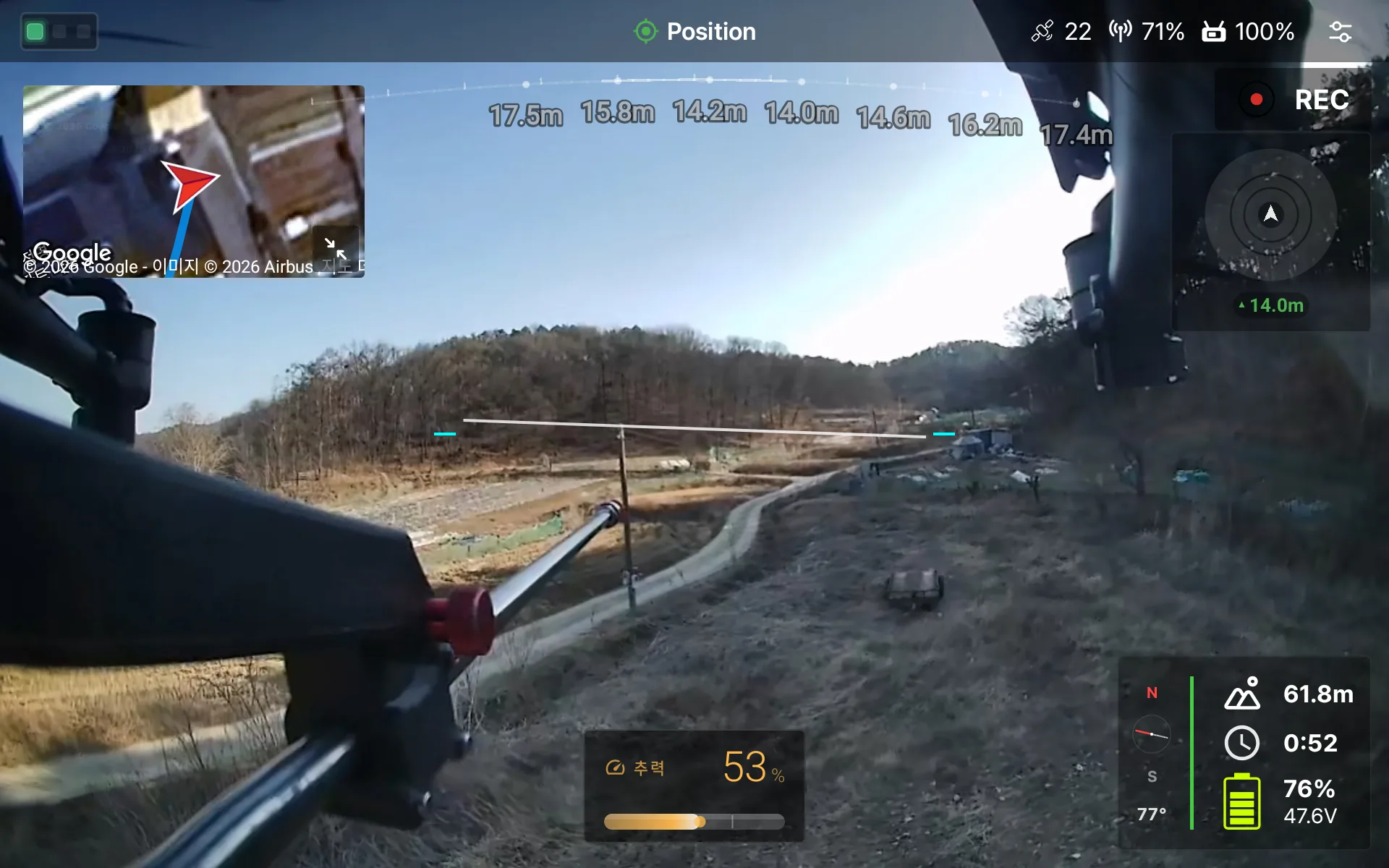
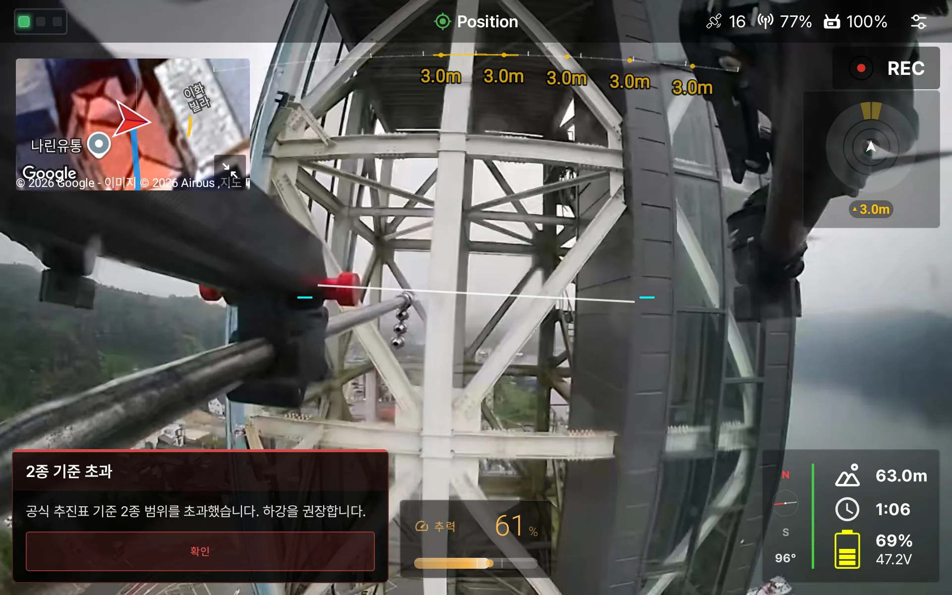
LiDAR + Radar
They detect windows, buildings and structures without exception. Detection range is approx. 40 m each, and accuracy is LiDAR ±2 cm · Radar ±0.1 m.
TTS + warning tones
In a hazardous situation, a popup with voice and warning tones lets the pilot respond at once.
DRTView integration
Our own ground control app draws sensor data, flight information and obstacle warnings in real time.
Folded in seconds,
into the car.
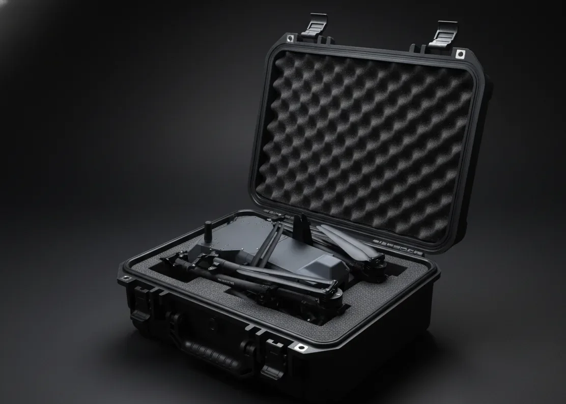
It folds to 1/3 of its operating size or less.It changes between operating and storage states in seconds with no loss of performance.
- Folded430 × 650 × 380 mm
- Unfolded1,220 × 1,160 × 380 mm
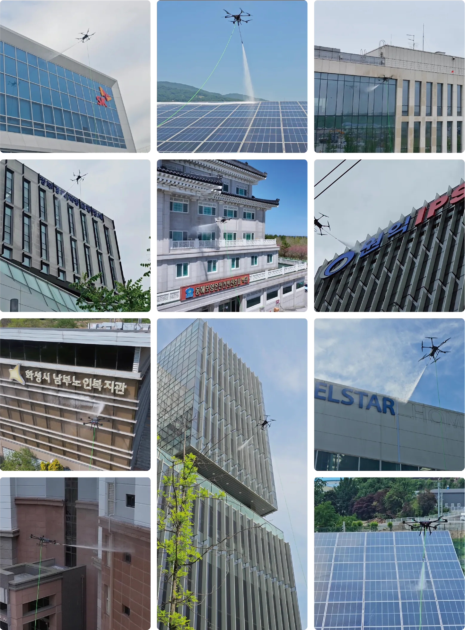
Proven in the field.
We learn and move forward in real fields, not in a lab.From commercial buildings to solar power plants, the feedback from every project refines NEXA1.
NEXA1 specifications
Aircraft
- Model
- DRT NEXA1
- Aircraft weight
- 14 kg
- Size (folded)
- 430 × 650 × 380 mm
- Size (unfolded)
- 1,220 × 1,160 × 380 mm
- Max takeoff weight
- 25 kg
- Wind resistance
- Up to 8 m/s
- Flight controller
- In-house firmware based on PX4
- GNSS
- RTK GNSS (GPS + Galileo + BeiDou + GLONASS)
- Position hold
- Sensor-based own positioning · Flight in GPS shadow zones and indoors · Omnidirectional obstacle avoidance
- Battery
- 44.4 V / 30,000 mAh / 12S LiPo · Approx. 30 minutes (hovering)
- Tether power
- 220 V AC → DC tethered power supply · Unlimited flight time
Cleaning
- Cleaning rate
- 725 m²/h
- Max water pressure
- 220 bar (20 L/min pump) · 120 bar (50 L/min pump)
- Max working height
- 100 m (depends on hose weight)
- Lance
- Tilt 45° · Auto Sweep
- Vertical AB
- Semi-automatic zigzag path generation · Automatic wall distance hold
Safety · Video
- Obstacle sensors
- LiDAR approx. 40 m · Radar approx. 40 mAccuracy LiDAR ±2 cm (at 10 m) · Radar ±0.1 m
- Warnings
- TTS voice · Warning tones · DRTView popup
- Water resistance
- IPX5 rating · Water-jet resistant (in-house test)
- Video system
- RTSP H.264 1080p · 160° ultra-wide lens · 1/2.7" CMOS · 1-axis gimbal
- Ground control software
- DRTView (in-house · Korean · English · Japanese)
- Options
- Fall-prevention parachute